

Almost every Road to Hana stop list is organized by mile marker, but the numbers don’t run in a single sequence. They restart where Highway 36 becomes Highway 360, then jump to the low 50s past Hana and count down. Misreading them is one of the most common ways visitors lose time on the road. This guide explains how the numbering works, which stops sit at which mile, how to avoid the usual mix-ups and what to plan for before you go.
How Road to Hana Mile Markers Are Numbered?
The drive uses three numbering sections:
- Highway 36, Kahului to the reset. Markers start at 0 in Kahului and climb to 16, near the Kaupakalua Road junction about 9 to 10 miles past Pa’ia.
- Highway 360, mile 0 to Hana. At that junction, the route number changes to 360 and the markers start over at 0. They climb to about 34 at Hana town. The mile markers in most travel guides refer to this section.
- Highway 31, past Hana. Beyond Hana, the road becomes the Pi’ilani Highway. The markers begin near 51 and count down toward Kipahulu.
The road keeps one name, the Hana Highway, through all three sections, so the change is easy to miss. The markers themselves are small green-and-white signs, and the route number on them is easy to overlook. Guidebooks, apps and printed maps almost always use the Highway 360 numbers, so those are the ones to know.
Where mile 0 begins
Many first-time drivers expect mile 0 to be near Pa’ia or Ho’okipa. It isn’t. The 0 marker sits at the junction where Highways 36, 360 and 365 meet, roughly 9 to 10 miles past Pa’ia. On the Highway 36 side, that same spot is marker 16.
Everything before it, including Pa’ia town, Ho’okipa Beach Park and Maliko Gulch, uses Highway 36 numbers. Some sources treat Pa’ia as the start of the Road to Hana and others treat the 0 marker that way, which is one reason published lists don’t always agree.
Mile Marker Quick Reference: Stops by Number
Mile markers are approximate guides, and sources can differ by a half mile or so.
| Mile Marker | Stop | Highway |
|---|---|---|
| Just before 9 | Hookipa Beach Park | 36 |
| 16 (becomes 0) | Reset point, Highway 36 meets 360 | 36 / 360 |
| 2 | Twin Falls | 360 |
| 9 | Waikamoi Ridge Trail | 360 |
| 10 | Garden of Eden Arboretum | 360 |
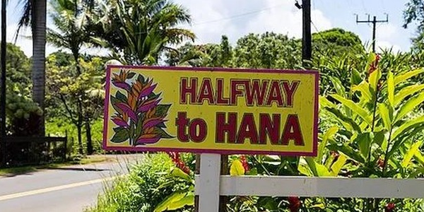
| 17 | Halfway to Hana banana bread stand | 360 |
| 31 | Ula’ino Road, Hana Lava Tube | 360 |
| 32 | Wai’anapanapa State Park (black sand beach) | 360 |
| 34 | Hana town | 360 |
| 42 | Ohe’o Gulch and the Pipiwai Trail area, Kipahulu | 31 |
| 45 | Wailua Falls | 31 |
| 51 | Hamoa Beach | 31 |
For a closer look at the waterfalls themselves, see our guide to the top waterfalls on the Road to Hana.
Why the Same Number Can Mean Two Places
Because the 0 to 16 range appears in two sections, one number can point to two locations. Mile 9 is a good example. On Highway 36, it sits at Hookipa Beach Park on the north shore. On Highway 360, it is the Waikamoi Ridge Trail, deep in the rainforest.
Stop lists add to the problem by giving a number without a highway. A list that says “mile 31” almost always means Highway 360 and the Hana Lava Tube turnoff, but nothing on the list tells you that. A quick check before you trust any marker:
- Which route number did I last pass: 36, 360, or 31?
- Have I reached Hana town yet?
- Is the number in the 40s or 50s? If so, you are past Hana on the Highway 31 side.
If the answers don’t match the stop you’re looking for, you’ve likely read the number from the wrong section.
How to Keep Track of Where You Are?
- Reset your trip odometer to 0 at the Highway 360 marker. It gives you a second way to confirm the numbers.
- Download offline maps before you leave Pa’ia. Signal can drop in the valleys and rainforest stretches.
- Use landmarks alongside numbers. Bridges, Keanae Peninsula and Hana Bay are easier to recognize than a small roadside sign.
- Let a passenger navigate. One person reading the list while the other watches the road avoids most missed turnoffs.
- Pull over only at safe turnouts. Slowing or stopping on a one-lane stretch to check a number backs up traffic and is hard to recover from.
What to Plan for Beyond the Mile Markers
The numbers are only part of a successful day on the road. A few other things are worth sorting out in advance:
- Black sand beach access. Wai’anapanapa State Park requires advance reservations for visitors, and there is no legal parking along the road outside it. Fees, time windows and booking rules change, so check the official Hawaii state parks reservation site before you go.
- An early start. Many guides recommend leaving between 6 and 7 a.m. to get ahead of the crowds and have more daylight for swimming.
- Supplies. Services are limited between Pa’ia and Hana. Fill the tank and pack water, snacks and sunscreen.
- Road conditions. Rockfalls and mudslides can close sections of the road, so check current conditions the morning you leave.
- Respect for residents. Communities along the road are people’s homes. Stay on public roadsides and turnouts, and don’t block driveways.
How Long the Drive Takes
The Hana Highway is commonly described as about 64 miles end to end, including the stretch past Hana. Hana town itself is roughly 52 miles from Kahului by road, and sources round that figure differently. The route has more than 600 curves and roughly 50 or more one-lane bridges.
Driving time is about two and a half to three hours one way without stops. With swim stops, lunch and traffic, most visitors need a full day, and the return drive adds time on top of that.
If You’d Rather Not Navigate the Numbers Yourself
Self-driving gives you flexibility to set your own pace. If you’d rather leave the driving, the mile markers and the stop order to someone else, Stardust Hawaii offers a guided Road to Hana tour in a Mercedes Sprinter van, with a professional driver-guide, groups of up to 14 guests and pickup from major Maui resorts. Breakfast, a deli-style lunch and snacks are included. Stops include Hookipa, Keanae Peninsula, a banana bread stand, the Wai’anapanapa black sand beach, Pua’a Ka’a Falls and the Wailua Valley Lookout, with swim time, weather permitting.
Itineraries can change with weather, road conditions, park closures or reservation availability, and if black sand beach access isn’t possible, a comparable stop is substituted.
Stardust Hawaii has operated on Maui for more than 15 years and holds a 4.9 rating from 300+ Google reviews, with 1,000+ reviews on TripAdvisor.
FAQs
Do the mile markers on the Road to Hana start over?
Yes. They reset to 0 where Highway 36 becomes Highway 360, then restart near 51 after Hana.
Where is mile marker 0?
At the junction where Highway 36 meets Highway 360, which is marker 16 on the Highway 36 side. It is roughly 9 to 10 miles past Pa’ia, beyond Hookipa Beach Park.
Why do the markers go backwards after Hana?
Past Hana, the road becomes Highway 31, which has its own numbering. It starts near 51 and counts down toward Kipahulu.
Can I rely on GPS instead of mile markers?
GPS helps, but coverage can drop in valleys and rainforest sections. Download offline maps and use the markers as a backup.
Do I need a reservation for the black sand beach?
Yes. Wai’anapanapa State Park requires advance reservations for visitors. Check the Hawaii State Parks reservation site for current availability, fees and time slots.